UltraGeographicMapはZoomToGeographic()メソッドを使用してプログラムから特定の領域をズームして表示させることが可能です。メソッドの引数には表示したい地理領域をRectangleで指定します。特定の地点を中心としたRectangleは、緯度と経度、および半径を表すdouble値より、以下のようなメソッドで求めることができます。
private Infragistics.Win.DataVisualization.Rectangle geographicFromCentered(double latitude, double longitude, double radius)
{
	Infragistics.Win.DataVisualization.Rectangle rect = new Infragistics.Win.DataVisualization.Rectangle()
	{
		X = longitude - radius,
		Y = latitude - radius,
		Width = radius * 2,
		Height = radius * 2,
	};

	return rect;
}
ここでは、東京駅(緯度: 35.681236 経度: 139.767125)を中心として半径0.004の範囲を表すRectangleを以下のように求めます。
double latitude = 35.681236;
double longitude = 139.767125;
double radius = 0.004;

Infragistics.Win.DataVisualization.Rectangle geoRect = geographicFromCentered(latitude, longitude, radius);
FormのLoadイベントで、上記で求めたRectangleを引数としてUltraGeographicMapのZoomToGeographic()メソッドを実行します。
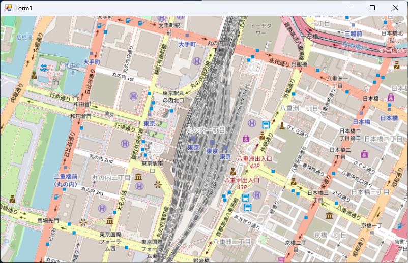
東京駅を中心としてマップが初期表示されました。